Alan Godfrey Maps
Manchester Oxford St. & Gaythorn 1849
Code:
£3.50
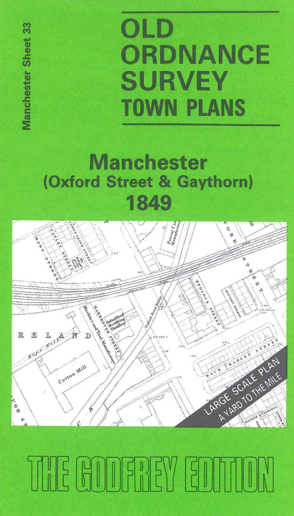
Godfrey Map Number 33. Manchester (Oxford Street and Gaythorn) 1849. 36 inches to 1 mile. Peter St. to north,river Medlock meanders across the south around M/c. Gas Works and Chorlton Mills. “Little Ireland” is isolated by the Medlock and the M/c. Jouth junction & Altrincham Railway. Knott Mill is to the south-west. Oxford St. runs north to south-east. M/c. & Salford Junction Canal joins Rochdale Canal between Great Bridgewater St. and the railway. Also shows Free Trade Hall, Theatre Royal, Museum of Natural History and St. Peter’s Church. Residential area around ByromSt. Deansgate and Lower Mosley St.