Alan Godfrey Maps
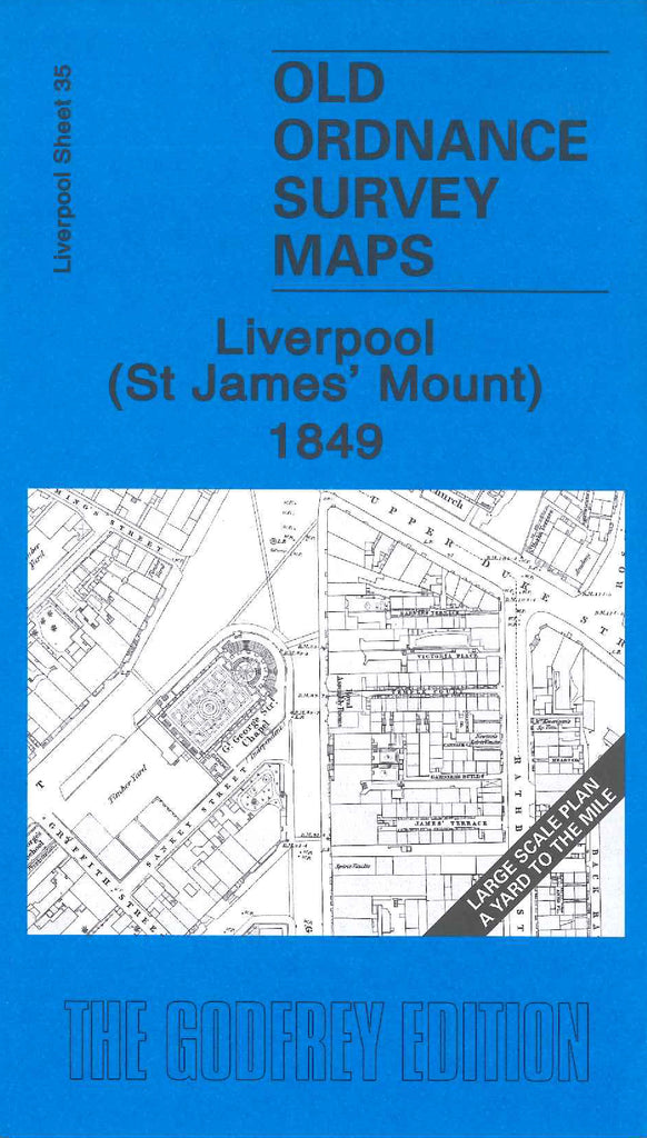
Liverpool (St James' Mount) 1849
Code:
£3.50
Godfrey Map Number 35. This large scale map fits to the right of the map of Liverpool (Wapping) 1849-64 (Code 3257) and below map Mount Pleasant 1848 (Code 3253). Shows mainly terraced housing with the middle of the map taken up with St James’ cemetery. Top left shows Cornwallis Street, top right Falkner Street, bottom left is Greenland Street and bottom right is Princes Park Road. Includes Gt George St Chapel, St James’ Market, Catholic Orphanage, Church of the Holy Apostle, St Bride’s Church, Presbyterian Church, etc.